
Looking to build a house or subdivide your block? You’ll need the help of a land surveyor company. Land surveys (also known as property surveys or cadastral surveys) are an important part of the construction and development process. While there are dozens of types of land surveys available, most projects only require a few common services. These common land surveys offer a wealth of information that decision makers, town planners and construction companies can use to plan and execute the work. In this blog we’ll take a look at the different types of land surveying and how they fit into the construction process.
Boundary and Identification Surveying
Boundary and identification surveys are some of the most common reports in the surveying industry. During a boundary survey, a professional team will visit your site to mark out the exact location of the property lines. This is done using a mixture of state-of-the-art GPS measuring equipment and historical research. In Australia, all properties have a registered title that shows its original boundaries. Over time boundaries tend to shift due to new construction projects, changes in the land and a blurring of property limits. That usually isn’t a major issue, but it’s important to know the exact size, location and boundaries of a property ahead of construction and development projects.
Many local councils in Australia require an up-to-date boundary survey to be submitted alongside building plans. This allows the council to better enforce building regulations, avoid disputes between neighbors and provide planning guidance to the construction company.
Feature Surveying
Boundary lines aren’t the only thing that has an impact on construction works. The features of a property also play an important role in planning and executing projects. During a feature survey, a professional team will visit the site to take precise measurements. They’ll use this information to draw a map of the site showing major features such as:
- Existing homes and other structures
- Major vegetation like hedges and trees
- The location of boulders
- Fences and retaining walls
- Utility and service runs
- Driveways and footpaths
The features of a site can have a major impact on the work involved in a project. For instance, a heavily wooded site could require clearing before work can begin. In that case, having a precise plan of the vegetation on the site would allow trades to provide accurate estimates about the work ahead.
Topographic Surveying
The shape and terrain of a property can have a big impact on how construction works are conducted. Terrain features like slopes, cliffs, valleys and rocky outcrops can all complicate the building process. For example, sloped residential blocks often require significant earthworks to flatten out the site. A topographic survey can provide volumetric information that allows the builder to plan for these works and coordinate the project with external contractors.
Topographic surveying often uses the surveying industry’s most advanced tools. Depending on how much information you need, modern surveying companies can even use drones to produce 3D models of the site. This is particularly useful when earthworks are required, or if the site needs additional engineering work.
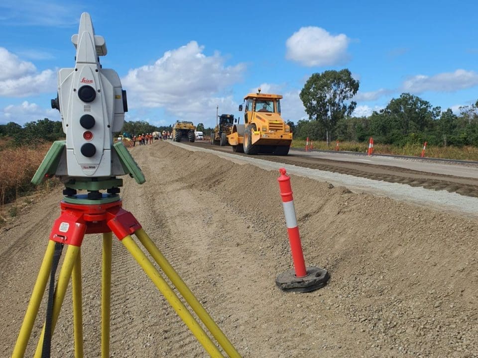
Construction and Engineering Surveying
Land surveys are commonly performed during the design, planning and approvals phase of a project. Beyond that, land surveyors are often also contracted to provide data during the construction process. Your land surveyor company will be able to offer a range of construction and engineering surveys that ensure the work is being completed correctly and according to specifications. Some common types of construction and engineering surveys are:
- Preconstruction surveys take place before the work begins. During the survey, a professional team will assess surrounding properties and neighboring buildings for signs of existing damage and defects. This ensures all parties know who is liable for any damage that may occur during construction.
- Set-out. The precise location of a structure is important to complying with building standards. Set-out surveys involve having a surveying company mark out the location of any earthworks, infrastructure, buildings and other structures according to the approved plans.
- Site monitoring. Site monitoring surveys may be performed regularly throughout a project. The focus of site monitoring surveys is to check neighboring buildings for signs of movement that could be dangerous. Measurements taken during each visit are compared to detect problems before they occur.
- As constructed. Things change during construction projects. That means the final result won’t alway be identical to the approved plans. As constructed surveys take a snapshot of the finished product that can later be used during further construction or renovation works.
- U.S. Energy Media Staffhttps://oilmanmagazine.com/author/oilmanwp/

- U.S. Energy Media Staffhttps://oilmanmagazine.com/author/oilmanwp/

- U.S. Energy Media Staffhttps://oilmanmagazine.com/author/oilmanwp/

- U.S. Energy Media Staffhttps://oilmanmagazine.com/author/oilmanwp/

- U.S. Energy Media Staffhttps://oilmanmagazine.com/author/oilmanwp/

- U.S. Energy Media Staffhttps://oilmanmagazine.com/author/oilmanwp/

- U.S. Energy Media Staffhttps://oilmanmagazine.com/author/oilmanwp/

- U.S. Energy Media Staffhttps://oilmanmagazine.com/author/oilmanwp/


Oil and gas operations are commonly found in remote locations far from company headquarters. Now, it's possible to monitor pump operations, collate and analyze seismic data, and track employees around the world from almost anywhere. Whether employees are in the office or in the field, the internet and related applications enable a greater multidirectional flow of information – and control – than ever before.